
Tuesday is AD&D night around here, so I'm spending some time before the game to get all my campaign ducks in a row, so to speak. One thing that's topping my list at the moment is an overland map - I don't have one (or at least one with a finer scale than the Darlene map's 30 mile hex - great for getting an overview, but not so useful for hexcrawl-style wilderness adventure). So far we've been concentrating on the dungeon (Castle Greyhawk), with the city itself (Free City of Greyhawk) only just starting to show up in play - but it's only a matter of time before somebody picks up one of the adventure hooks laying around (or gets bored) and wants to do some hiking.
Bat in the Attic blog (a fine OSR destination if you haven't checked it out yet) outlines 34 steps to make a fantasy sandbox, and I'm dying to try his method. The first three steps (1 world map, 2 label important regions, 3 write region blurbs) are already taken care of thanks to the World of Greyhawk folio, and step 4 is to choose your starting region - again, centering on the Free City of Greyhawk, the choice is made for me. Steps 5-10 involve detailing the local map, so that's where I'll be starting.
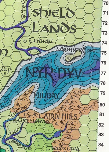
Now, surprisingly, there's not a single zoomed-in hexmap of the Greyhawk region that I can find. There are plenty of beautifully illustrated maps out there, most of which look like they'd be useless in my gaming (and most of which incorporate elements from 2e modules and the 3e Living Greyhawk campaign, none of which I'm using). So it falls to me to create a usable hexcrawl map of the area. I'll likely be doing this with the DMG random terrain tables as inspiration (although I'll place the result generated with some mind as to "realistic" terrain).
Something else I stumbled across last night: Bat in the Attic has also put up a great rundown-by-pantheon of the Greyhawk deities - something I've meant to do for quite some time (long enough that I probably never would have). The posting is HERE, and the full rundown is HERE. Great stuff.


IIRC, module T1-4: Temple of Elemental Evil has one of Greyhawk's 30-mile hexes blown-up.
ReplyDeleteRight you are - just not the one I need. I'm running my game based out of the Free City of Greyhawk; T1-4 covers Hommlet and Nulb (some 10-20 "big hexes" to the west). Funny you mention, I've actually already re-drawn that same map (as I wasn't a fan of the "expanded" distances between towns presented in T1-4 vs. how they were presented in T1). One of my earliest hexcrawl experiments; I still have the way-too-obsessively-involved encounter tables (by region) that I drew up for that campaign. Thankfully I've learned to strip things down a BIT since then.
ReplyDeleteHave you seen these maps?
ReplyDeletehttp://ghmaps.net/
Based off of Darlene's but at much greater detail. The artist lets you turn off a lot of the symbols in the pdf. Copy that into Gimp and through a hex grid on it and you might be done.
It is post-wars. But if you want the Bandit Kingdoms around you can simply turn off the nation labels in the layers of the pdf.
Hmmm... I'm intrigued by those (seen'em before and they are pretty, I'll give you that), but I sorta doubt their gaming utility (at least in the style of hexcrawl I want to do, here). I think I need a little more "hex tiles" and a little less "Google Oerth", if that makes any sense. Those lovely feathered hills are exactly what I don't need; I want hills more or less conforming to the hexes (for the map, not so much in-world).
ReplyDelete(That said, the coastlines are really nicely done, and that's a feature I DO want to represent graphically on the map. Hmmm...)
ReplyDelete